Apitamkiejit Wind Energy Project

The Apitamkiejit Wind Energy Project is a proposed renewable energy facility with a total capacity of up to 68 MW. The project will be comprised of up to ten turbines with a nameplate capacity between 5.9 to 7.2 MW.

The facility would be located on privately-held land in Queens county, north-west of highway 103. The project is being developed through a partnership including one or more First Nation communities that are yet to be disclosed, and SWEB Development LP (SWEB Energy), a Halifax-based renewable energy developer and operator.
Location Description
located on privately-held land in Queens county, north-west of highway 103
Project Partners
LandOwners
Project Status
Proposed
Purpose
Local Grid
Onshore/Offshore
Onshore
Number of Turbines
10
Total Project Capacity (MW)
68.00
Commissioning Year
2027
Signed Offtake Deals
No
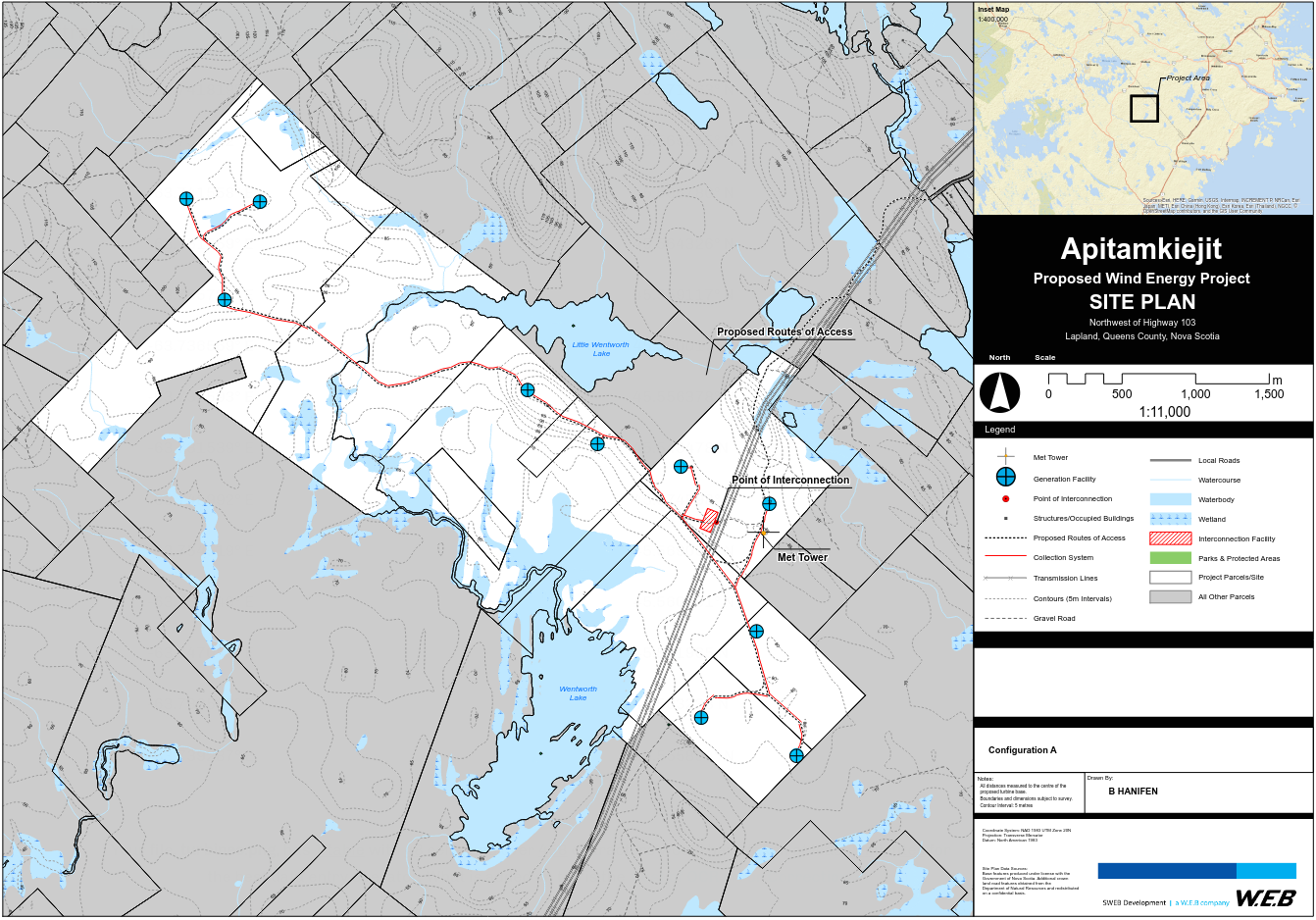
Proposed Site Plan
Project Documents
Attachment Size
project_area.png (1.26 MB) 1.26 MB

Nova Scotia Wind Turbines

This map is an attempt to document existing and proposed wind turbines in Nova Scotia

Areas outlined in yellow are the proposed project boundaries

Red dots represent turbine locations

Yellow areas with no dots are locations that I do not have turbine location data for

The data has been harvested from various project Environmental Assessment documents, company websites and databases from the Govt of Canada

Project boundary WKT polygons were created by overlaying company site plan images and tracing as best as possible... there may be discrepancies

Project boundaries that are represented as simple rectangular objects are projects that I do not have good data for so locations are estimated based on publicly available 'clues' as to locations

If any company would like to provide data for either project boundaries or turbine locations, I'd be happy to update the map

Use the map full-screen icon/control to get the best viewing experience

Turbines in this project